
 I wasn't trying to find another picture where yellow is the dominant color for two consecutive "A Photo A Day" pictures. But here's another photo with yellow. . .
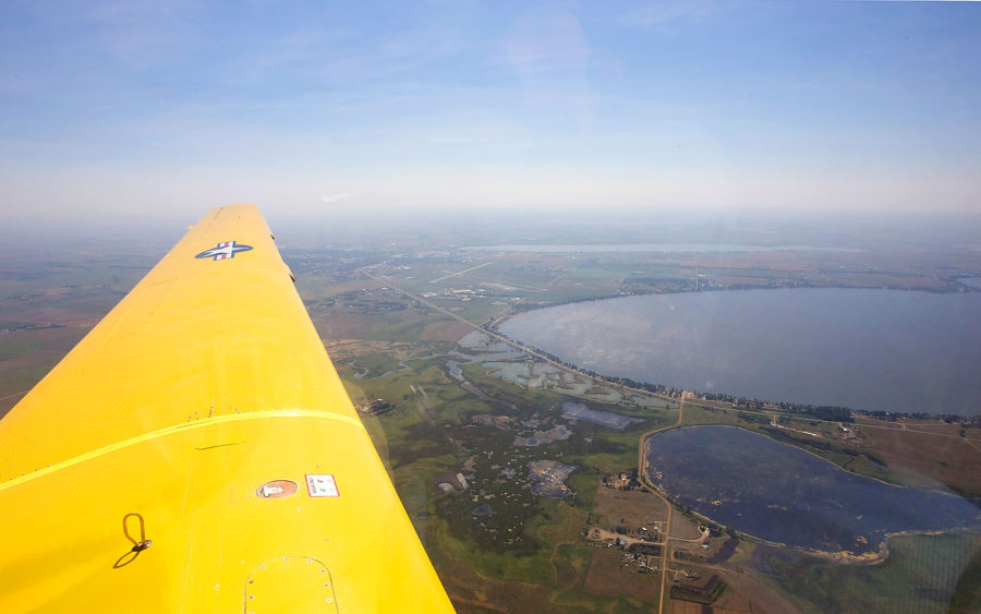
A few years ago I was invited to take a ride in the Lake Area Technical Institute glider. Greg Klein was the pilot and we had a great trip. This is a powered glider, which means that it uses a conventional engine and propeller to take off but once the plane climbs to 10,000 feet or so, the engine is turned off. Greg told me that the engine could be re-started but I could tell that this wasn't considered "cool." Thus, we landed as a glider. Another thing that wasn't cool was when Greg took his hands off the controls and told me to steer. Shortly after that, I started to hear a beep, which Greg calmly told me was the "stall warning indicator." I quickly turned control over to him. I'd rather take pictures than fly a plane.
In this photo we are a little north of Lake Kampeska. The skinny body of water towards the top of the photo is Lake Pelican. The Watertown airport is visible just forward of the end of the wing. If you are wondering why there is a military insignia on the wing, it is because this plane was used as a trainer by the Air Force Academy and then was "retired." Now LATI is putting it to good use with their students in the aviation program. Another good use is giving people like me rides. Have I said how impressed I am with Lake Area Technical Institute?
Canon 1D Mark II 1/500s f/16.0 ISO320 17mm (Canon 17-24mm f/4.0L)
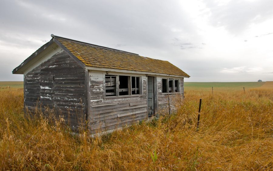 Several years ago we had a governor who instituted a program to destroy abandoned farmsteads, which allegedly become havens for rodents and predators. Fortunately, the program wasn't all that successful and there are still many old houses, barns and sheds scattered through the countryside.
 One oak leaf back lit by the morning sun - it doesn't get much simpler than this. Since I was shooting into the sun, the challenge was to find shade for the lens to avoid lens flare. From the sunny side, this leaf looked dull. But with the sun shining through it, the leaf came to life - which is a bit of an irony for a leaf about to fall.
