By Scott Shephard

Blocked Road - Isaac Hale Beach Park (Big Island Hawaii)
I guess this is day two of my volcano-themed posts. Yesterday, I showed you some pictures of the spectacular eruption from the Kilauea caldera. But the lava you saw there doesn’t really threaten the Big Island of Hawaii. The lava that damages and destroys comes out of fissures which are sometimes well away from yesterday’s location.
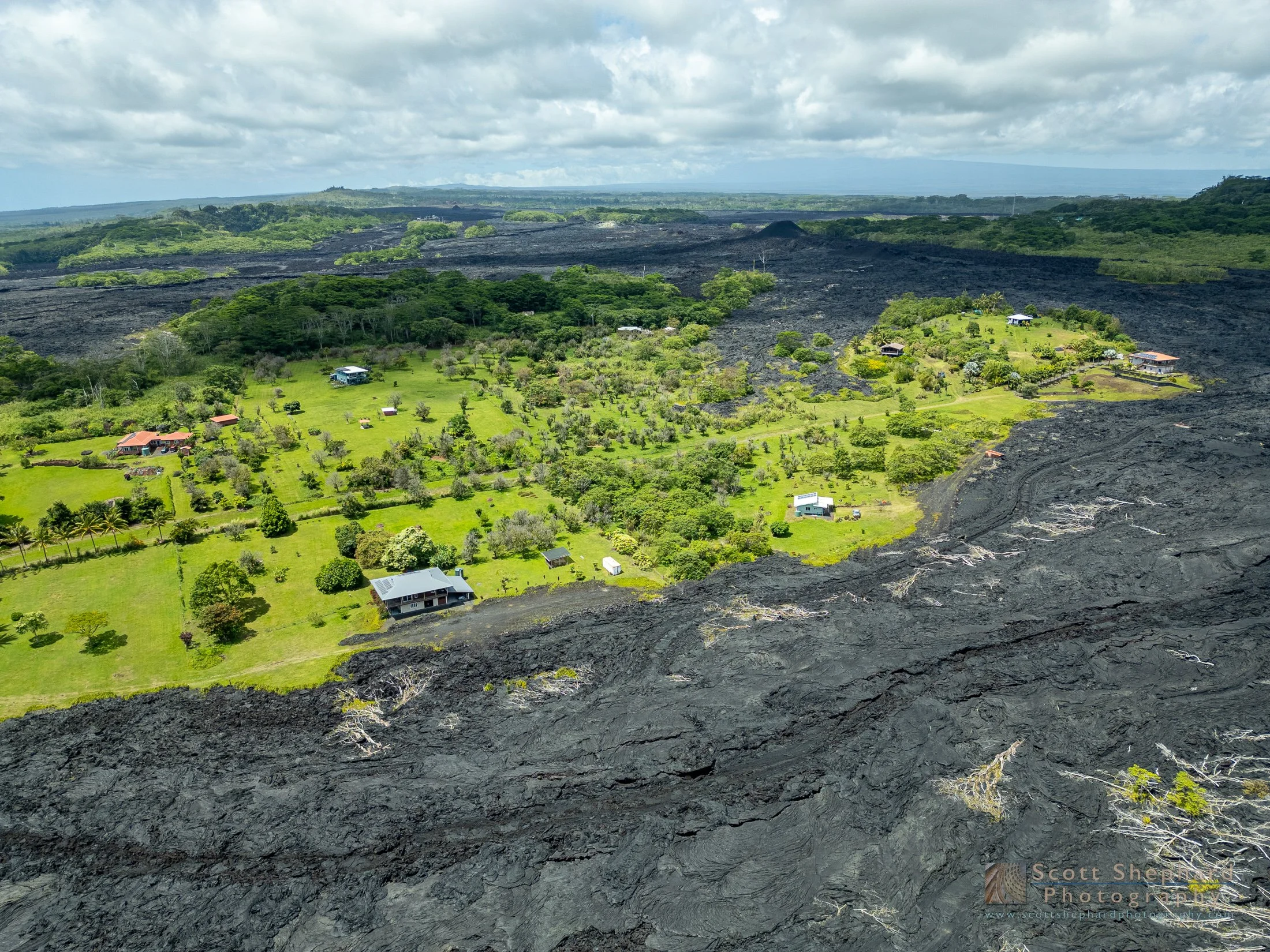
In this photo you see the effects of the 2018 Puna eruption. The eruption began in May of that year and more or less ended by early August. The lava flow ended up covering 14 square miles and destroying 700 homes, including all of the homes at a place called Vacationland where our family had stayed several times over the years. It also boiled and destroyed Green Lake, once the largest fresh water lake in all of Hawaii. As far as I know, no one died in this this massive eruption because the front edge of a lava flow generally moves slower that even a slow runner can run.
In the following photos (the first two of which are not mine) you can see some of the results of the 2018 eruption. The first two photos are USGS photos of the flow from the air and of the flow as is rolled down a street in the Leilani Estates housing development. The next three show main Big Island roads and evidence that reconstruction has begun. The photo with the green crescent is what used to be known as Green Mountain and Green Lake. The final photo shows the capricious nature of lava flows - some houses are buried and others are spared.
One of the odd benefits of the 2018 eruption is that the Big Island is bigger by 875 acres, though it will take decades or maybe centuries for the land the be habitable and lush.